Weather Warnings Archive: Tuesday 30 Jun 2026 10:04 BST - UK


00:00-06:00
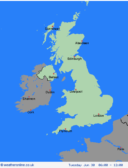
06:00-12:00

12:00-18:00

18:00-24:00


Severe Weather Warnings: Rain
issued by the Metoffice at
09:04, 30.06.2026
valid from
14:00, 30.06.2026
until
21:00, 30.06.2026
Region: Strathclyde
Following rain overnight and this morning, which could be heavy at times, showers are expected to break out this afternoon which are likely to be slow-moving. A few places could see 20 mm in an hour, and there is a chance that the odd location could see 30-40mm in 2-3 hours. This may lead to some localised flooding and travel disruption across parts of central Scotland. The heaviest showers may be accompanied by thunder but showers will tend to steadily fade through the evening. What Should I Do? Check if your property could be at risk of flooding. If so, consider preparing a flood plan and an emergency flood kit. Give yourself the best chance of avoiding delays by checking road conditions if driving, or bus and train timetables, amending your travel plans if necessary. People cope better with power cuts when they have prepared for them in advance. It’s easy to do; consider gathering torches and batteries, a mobile phone power pack and other essential items. Be prepared for weather warnings to change quickly: when a weather warning is issued, the Met Office recommends staying up to date with the weather forecast in your area.
Chief ForecasterRain followed by slow-moving, heavy showers may lead to some temporary flooding in places.
The public is advised to take extra care, further information and advice can be found here: http://www.metoffice.gov.uk/weather/uk/links.html
Severe Weather Warnings: Rain
issued by the Metoffice at
09:04, 30.06.2026
valid from
14:00, 30.06.2026
until
21:00, 30.06.2026
Region: Central, Tayside & Fife
Following rain overnight and this morning, which could be heavy at times, showers are expected to break out this afternoon which are likely to be slow-moving. A few places could see 20 mm in an hour, and there is a chance that the odd location could see 30-40mm in 2-3 hours. This may lead to some localised flooding and travel disruption across parts of central Scotland. The heaviest showers may be accompanied by thunder but showers will tend to steadily fade through the evening. What Should I Do? Check if your property could be at risk of flooding. If so, consider preparing a flood plan and an emergency flood kit. Give yourself the best chance of avoiding delays by checking road conditions if driving, or bus and train timetables, amending your travel plans if necessary. People cope better with power cuts when they have prepared for them in advance. It’s easy to do; consider gathering torches and batteries, a mobile phone power pack and other essential items. Be prepared for weather warnings to change quickly: when a weather warning is issued, the Met Office recommends staying up to date with the weather forecast in your area.
Chief ForecasterRain followed by slow-moving, heavy showers may lead to some temporary flooding in places.
The public is advised to take extra care, further information and advice can be found here: http://www.metoffice.gov.uk/weather/uk/links.html
Severe Weather Warnings: Rain
issued by the Metoffice at
09:04, 30.06.2026
valid from
14:00, 30.06.2026
until
21:00, 30.06.2026
Region: SW Scotland, Lothian Borders
Following rain overnight and this morning, which could be heavy at times, showers are expected to break out this afternoon which are likely to be slow-moving. A few places could see 20 mm in an hour, and there is a chance that the odd location could see 30-40mm in 2-3 hours. This may lead to some localised flooding and travel disruption across parts of central Scotland. The heaviest showers may be accompanied by thunder but showers will tend to steadily fade through the evening. What Should I Do? Check if your property could be at risk of flooding. If so, consider preparing a flood plan and an emergency flood kit. Give yourself the best chance of avoiding delays by checking road conditions if driving, or bus and train timetables, amending your travel plans if necessary. People cope better with power cuts when they have prepared for them in advance. It’s easy to do; consider gathering torches and batteries, a mobile phone power pack and other essential items. Be prepared for weather warnings to change quickly: when a weather warning is issued, the Met Office recommends staying up to date with the weather forecast in your area.
Chief ForecasterRain followed by slow-moving, heavy showers may lead to some temporary flooding in places.
The public is advised to take extra care, further information and advice can be found here: http://www.metoffice.gov.uk/weather/uk/links.html
Severe Weather Warnings: Thunderstorms
issued by the Metoffice at
09:04, 30.06.2026
valid from
12:00, 30.06.2026
until
18:00, 30.06.2026
Region: Northern Ireland
Following overnight rain, showers and thunderstorms are expected to develop across much of Northern Ireland. These showers and thunderstorms will become slow-moving for a time this afternoon, leading to the potential for some large rainfall accumulations to build up in a few places. 10-15 mm of rain likely in less than an hour for some, and perhaps 25-30 mm in 2-3 hours. This could cause some temporary flooding and difficult driving conditions. Hail and lightning will be additional hazards in the heaviest showers. What Should I Do? Consider if your location is at risk of flash flooding. If so, consider preparing a flood plan and an emergency flood kit. Give yourself the best chance of avoiding delays by checking road conditions if driving, or bus and train timetables, amending your travel plans if necessary. People cope better with power cuts when they have prepared for them in advance. It’s easy to do; consider gathering torches and batteries, a mobile phone power pack and other essential items. If you find yourself outside and hear thunder, protect yourself by finding a safe enclosed shelter (such as a car). Do not shelter under or near trees, or other structures which may be struck by lightning. If you are on an elevated area move to lower ground. Be prepared for weather warnings to change quickly: when a weather warning is issued, the Met Office recommends staying up to date with the weather forecast in your area.
Chief ForecasterSlow-moving thunderstorms this afternoon may cause travel disruption and flooding in a few places.
The public is advised to take extra care, further information and advice can be found here: http://www.metoffice.gov.uk/weather/uk/links.html


30.06.2026